Cyclocane
( cyclocane is a CYCLOne and hurriCANE tracker by hayley )


Hayley here - Do you like lofi music whatever music Hayley put on and terrifyingly loud computer voices? Then stop by the 24/7 ish severe weather live stream!
* stats delayed and were probably not accurate to begin with
English Español Deutsch Français 日本語
ERIN 現在の気象条件
現時点で風 80 knots / 90 MPH
予測最大風速 85 knots / 100 MPH at
勧告と警告、気象レーダー、衛星
current US watches/warnings

live tornado/thunderstorm tracker - tornadohq
future radar imagery - my future radar

future radar imagery

(above image is an example of the Western North Atlantic page - see Atlantic future radar page for a full set of images)
If a tropical storm or hurricane is threatening land, you can check my future radar for an idea of what radar might look like as the storm approaches.
ERIN 土地の危険
NWS Local Hurricane Statements
- No warnings
進路 ERIN
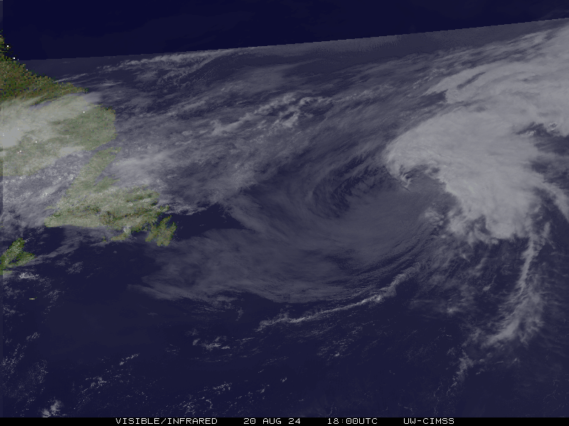
ERIN 衛星
NHCのERINの地図
ERIN 数値予報モデル
ERIN 勧告と警告

ERIN デタ NHC
| 時間 | 時間 | 中心位置 | status |
|---|---|---|---|
| 80 ノット | 40.0, -59.7 | 温帯低気圧 | |
| 80 ノット | 41.5, -54.5 | 温帯低気圧 | |
| 75 ノット | 44.0, -45.5 | 温帯低気圧 | |
| 75 ノット | 48.0, -35.5 | 温帯低気圧 | |
| 85 ノット | 52.0, -27.0 | 温帯低気圧 | |
| 65 ノット | 55.0, -23.0 | 温帯低気圧 | |
| 55 ノット | 58.0, -21.0 | 温帯低気圧 | |
| 45 ノット | 59.0, -21.0 | 温帯低気圧 | |
| 40 ノット | 57.0, -17.5 | 温帯低気圧 |
site by Hayley Croft
Hi, I'm Hayley. Did you know that I run this site out of my own pocket? So if you'd like to help support this site:
- Tell your friends about Cyclocane
- Buy something through this Amazon Cyclocane link
- make a donation - totally optional but completely appreciated
Make a monthly donation or a one-time donation to help support ongoing costs with Cyclocane.
Play solitaire and track all of the cyclocane storms at the same time at Hurricane Solitaire.