Cyclocane
( cyclocane is a CYCLOne and hurriCANE tracker by hayley )
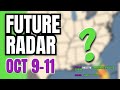
Hurricane Watch - Miami FL AL142024
599
WTUS82 KMFL 101202
TCVMFL
URGENT - IMMEDIATE BROADCAST REQUESTED
Milton Local Watch/Warning Statement/Intermediate Advisory Number 21A
National Weather Service Miami FL AL142024
802 AM EDT Thu Oct 10 2024
FLZ168-101315-
/O.CAN.KMFL.TR.W.1014.000000T0000Z-000000T0000Z/
Coastal Palm Beach County-
802 AM EDT Thu Oct 10 2024
TROPICAL STORM WARNING IS CANCELLED
LOCATIONS AFFECTED
- West Palm Beach
- Boca Raton
- Juno Beach
- Jupiter
- West Palm Beach
WIND
- LATEST LOCAL FORECAST: Below tropical storm force wind
- Peak Wind Forecast: 20-30 mph with gusts to 40 mph
- Peak Wind Forecast: 20-30 mph with gusts to 40 mph
- THREAT TO LIFE AND PROPERTY THAT INCLUDES TYPICAL FORECAST
UNCERTAINTY IN TRACK, SIZE AND INTENSITY: Wind less than 39 mph
- The wind threat has decreased from the previous assessment.
- PLAN: The threat of hazardous wind has subsided.
- PREPARE: Heed instructions from local officials when moving
about. Avoid restricted areas. - ACT: Dial 9 1 1 if you have a life-threatening emergency.
Practice safety when moving about.
- The wind threat has decreased from the previous assessment.
- REALIZED IMPACTS: Being Assessed
- Little to no additional wind impacts expected. Community
officials are now assessing the extent of actual wind
impacts accordingly.
- Little to no additional wind impacts expected. Community
- LATEST LOCAL FORECAST: Below tropical storm force wind
STORM SURGE
- No storm surge inundation forecast
- THREAT TO LIFE AND PROPERTY THAT INCLUDES TYPICAL FORECAST
UNCERTAINTY IN TRACK, SIZE AND INTENSITY: Little to no storm
surge flooding
- The storm surge threat has remained nearly steady from the
previous assessment. - PLAN: There is little to no threat of storm surge flooding.
Rough surf, coastal erosion, and life-threatening rip
currents are possible. - PREPARE: Little to no preparations for storm surge flooding
are needed. - ACT: Follow the instructions of local officials. Monitor
forecasts.
- The storm surge threat has remained nearly steady from the
- POTENTIAL IMPACTS: Little to None
- Little to no potential impacts from storm surge flooding.
- Little to no potential impacts from storm surge flooding.
- No storm surge inundation forecast
FLOODING RAIN
- LATEST LOCAL FORECAST:
- Peak Rainfall Amounts: Additional around 1 inch
- Peak Rainfall Amounts: Additional around 1 inch
- THREAT TO LIFE AND PROPERTY THAT INCLUDES TYPICAL FORECAST
UNCERTAINTY IN TRACK, SIZE AND INTENSITY: Little or no
potential for flooding rain
- The flooding rain threat has decreased from the previous
assessment. - PLAN: There is little or no potential for flooding rain.
- PREPARE: Little to no preparations are needed to protect
against flooding rain at this time. - ACT: Monitor for changes to the forecast.
- The flooding rain threat has decreased from the previous
- POTENTIAL IMPACTS: Little to None
- Little to no potential impacts from flooding rain.
- Little to no potential impacts from flooding rain.
- LATEST LOCAL FORECAST:
TORNADO
- LATEST LOCAL FORECAST:
- Situation is unfavorable for tornadoes
- Situation is unfavorable for tornadoes
- THREAT TO LIFE AND PROPERTY THAT INCLUDES TYPICAL FORECAST
UNCERTAINTY IN TRACK, SIZE AND INTENSITY: Tornadoes not expected
- The tornado threat has decreased from the previous
assessment. - PLAN: Tornadoes are not expected. Showers and thunderstorms
with gusty winds may still occur. - PREPARE: Little to no preparations needed to protect
against tornadoes at this time. Keep informed of the latest
tornado situation. - ACT: Listen for changes in the forecast.
- The tornado threat has decreased from the previous
- POTENTIAL IMPACTS: Little to None
- Little to no potential impacts from tornadoes.
- Little to no potential impacts from tornadoes.
- LATEST LOCAL FORECAST:
FOR MORE INFORMATION:
- https://www.weather.gov/mfl
- www.co-palm-beach.fl.us
- For storm information call 2-1-1
- https://www.weather.gov/mfl
FLZ068-101315-
/O.CAN.KMFL.TR.W.1014.000000T0000Z-000000T0000Z/
Metro Palm Beach County-
802 AM EDT Thu Oct 10 2024
TROPICAL STORM WARNING IS CANCELLED
LOCATIONS AFFECTED
- Boca West
- Palm Springs
- Florida Gardens
- Palm Beach Gardens
- Boca West
WIND
- LATEST LOCAL FORECAST: Below tropical storm force wind
- Peak Wind Forecast: 20-30 mph with gusts to 40 mph
- Peak Wind Forecast: 20-30 mph with gusts to 40 mph
- THREAT TO LIFE AND PROPERTY THAT INCLUDES TYPICAL FORECAST
UNCERTAINTY IN TRACK, SIZE AND INTENSITY: Wind less than 39 mph
- The wind threat has decreased from the previous assessment.
- PLAN: The sustained wind should remain less than tropical
storm force. Conditions may still be gusty. - PREPARE: Listen for any instructions from local officials.
- ACT: Ensure emergency readiness should the forecast change.
- The wind threat has decreased from the previous assessment.
- REALIZED IMPACTS: Being Assessed
- Little to no additional wind impacts expected. Community
officials are now assessing the extent of actual wind
impacts accordingly.
- Little to no additional wind impacts expected. Community
- LATEST LOCAL FORECAST: Below tropical storm force wind
FLOODING RAIN
- LATEST LOCAL FORECAST:
- Peak Rainfall Amounts: Additional around 1 inch
- Peak Rainfall Amounts: Additional around 1 inch
- THREAT TO LIFE AND PROPERTY THAT INCLUDES TYPICAL FORECAST
UNCERTAINTY IN TRACK, SIZE AND INTENSITY: Little or no
potential for flooding rain
- The flooding rain threat has decreased from the previous
assessment. - PLAN: There is little or no potential for flooding rain.
- PREPARE: Little to no preparations are needed to protect
against flooding rain at this time. - ACT: Monitor for changes to the forecast.
- The flooding rain threat has decreased from the previous
- POTENTIAL IMPACTS: Little to None
- Little to no potential impacts from flooding rain.
- Little to no potential impacts from flooding rain.
- LATEST LOCAL FORECAST:
TORNADO
- LATEST LOCAL FORECAST:
- Situation is unfavorable for tornadoes
- Situation is unfavorable for tornadoes
- THREAT TO LIFE AND PROPERTY THAT INCLUDES TYPICAL FORECAST
UNCERTAINTY IN TRACK, SIZE AND INTENSITY: Tornadoes not expected
- The tornado threat has decreased from the previous
assessment. - PLAN: Tornadoes are not expected. Showers and thunderstorms
with gusty winds may still occur. - PREPARE: Little to no preparations needed to protect
against tornadoes at this time. Keep informed of the latest
tornado situation. - ACT: Listen for changes in the forecast.
- The tornado threat has decreased from the previous
- POTENTIAL IMPACTS: Little to None
- Little to no potential impacts from tornadoes.
- Little to no potential impacts from tornadoes.
- LATEST LOCAL FORECAST:
FOR MORE INFORMATION:
- https://www.weather.gov/mfl
- www.co-palm-beach.fl.us
- For storm information call 2-1-1
- https://www.weather.gov/mfl
FLZ067-101315-
/O.CAN.KMFL.TR.W.1014.000000T0000Z-000000T0000Z/
Inland Palm Beach County-
802 AM EDT Thu Oct 10 2024
TROPICAL STORM WARNING IS CANCELLED
LOCATIONS AFFECTED
- Wellington
- Lion Country Safari
- Belle Glade
- Pahokee
- Wellington
WIND
- LATEST LOCAL FORECAST: Below tropical storm force wind
- Peak Wind Forecast: 20-30 mph with gusts to 40 mph
- Peak Wind Forecast: 20-30 mph with gusts to 40 mph
- THREAT TO LIFE AND PROPERTY THAT INCLUDES TYPICAL FORECAST
UNCERTAINTY IN TRACK, SIZE AND INTENSITY: Wind less than 39 mph
- The wind threat has decreased from the previous assessment.
- PLAN: The sustained wind should remain less than tropical
storm force. Conditions may still be gusty. - PREPARE: Listen for any instructions from local officials.
- ACT: Ensure emergency readiness should the forecast change.
- The wind threat has decreased from the previous assessment.
- REALIZED IMPACTS: Being Assessed
- Little to no additional wind impacts expected. Community
officials are now assessing the extent of actual wind
impacts accordingly.
- Little to no additional wind impacts expected. Community
- LATEST LOCAL FORECAST: Below tropical storm force wind
FLOODING RAIN
- LATEST LOCAL FORECAST:
- Peak Rainfall Amounts: No additional significant rainfall
forecast
- Peak Rainfall Amounts: No additional significant rainfall
- THREAT TO LIFE AND PROPERTY THAT INCLUDES TYPICAL FORECAST
UNCERTAINTY IN TRACK, SIZE AND INTENSITY: Little or no
potential for flooding rain
- The flooding rain threat has decreased from the previous
assessment. - PLAN: There is little or no potential for flooding rain.
- PREPARE: Little to no preparations are needed to protect
against flooding rain at this time. - ACT: Monitor for changes to the forecast.
- The flooding rain threat has decreased from the previous
- POTENTIAL IMPACTS: Little to None
- Little to no potential impacts from flooding rain.
- Little to no potential impacts from flooding rain.
- LATEST LOCAL FORECAST:
TORNADO
- LATEST LOCAL FORECAST:
- Situation is unfavorable for tornadoes
- Situation is unfavorable for tornadoes
- THREAT TO LIFE AND PROPERTY THAT INCLUDES TYPICAL FORECAST
UNCERTAINTY IN TRACK, SIZE AND INTENSITY: Tornadoes not expected
- The tornado threat has decreased from the previous
assessment. - PLAN: Tornadoes are not expected. Showers and thunderstorms
with gusty winds may still occur. - PREPARE: Little to no preparations needed to protect
against tornadoes at this time. Keep informed of the latest
tornado situation. - ACT: Listen for changes in the forecast.
- The tornado threat has decreased from the previous
- POTENTIAL IMPACTS: Little to None
- Little to no potential impacts from tornadoes.
- Little to no potential impacts from tornadoes.
- LATEST LOCAL FORECAST:
FOR MORE INFORMATION:
- https://www.weather.gov/mfl
- www.co-palm-beach.fl.us
- For storm information call 2-1-1
- https://www.weather.gov/mfl
FLZ063-101315-
/O.CAN.KMFL.TR.W.1014.000000T0000Z-000000T0000Z/
Glades-
802 AM EDT Thu Oct 10 2024
TROPICAL STORM WARNING IS CANCELLED
LOCATIONS AFFECTED
- Palmdale
- Moore Haven
- Brighton Seminole
- Palmdale
WIND
- LATEST LOCAL FORECAST: Below tropical storm force wind
- Peak Wind Forecast: 20-30 mph with gusts to 35 mph
- Peak Wind Forecast: 20-30 mph with gusts to 35 mph
- THREAT TO LIFE AND PROPERTY THAT INCLUDES TYPICAL FORECAST
UNCERTAINTY IN TRACK, SIZE AND INTENSITY: Wind less than 39 mph
- The wind threat has decreased from the previous assessment.
- PLAN: The sustained wind should remain less than tropical
storm force. Conditions may still be gusty. - PREPARE: Listen for any instructions from local officials.
- ACT: Ensure emergency readiness should the forecast change.
- The wind threat has decreased from the previous assessment.
- REALIZED IMPACTS: Being Assessed
- Little to no additional wind impacts expected. Community
officials are now assessing the extent of actual wind
impacts accordingly.
- Little to no additional wind impacts expected. Community
- LATEST LOCAL FORECAST: Below tropical storm force wind
FLOODING RAIN
- LATEST LOCAL FORECAST:
- Peak Rainfall Amounts: No additional significant rainfall
forecast
- Peak Rainfall Amounts: No additional significant rainfall
- THREAT TO LIFE AND PROPERTY THAT INCLUDES TYPICAL FORECAST
UNCERTAINTY IN TRACK, SIZE AND INTENSITY: Little or no
potential for flooding rain
- The flooding rain threat has decreased from the previous
assessment. - PLAN: There is little or no potential for flooding rain.
- PREPARE: Little to no preparations are needed to protect
against flooding rain at this time. - ACT: Monitor for changes to the forecast.
- The flooding rain threat has decreased from the previous
- POTENTIAL IMPACTS: Little to None
- Little to no potential impacts from flooding rain.
- Little to no potential impacts from flooding rain.
- LATEST LOCAL FORECAST:
TORNADO
- LATEST LOCAL FORECAST:
- Situation is unfavorable for tornadoes
- Situation is unfavorable for tornadoes
- THREAT TO LIFE AND PROPERTY THAT INCLUDES TYPICAL FORECAST
UNCERTAINTY IN TRACK, SIZE AND INTENSITY: Tornadoes not expected
- The tornado threat has decreased from the previous
assessment. - PLAN: Tornadoes are not expected. Showers and thunderstorms
with gusty winds may still occur. - PREPARE: Little to no preparations needed to protect
against tornadoes at this time. Keep informed of the latest
tornado situation. - ACT: Listen for changes in the forecast.
- The tornado threat has decreased from the previous
- POTENTIAL IMPACTS: Little to None
- Little to no potential impacts from tornadoes.
- Little to no potential impacts from tornadoes.
- LATEST LOCAL FORECAST:
FOR MORE INFORMATION:
- https://www.weather.gov/mfl
- www.myglades.com
- For storm information call 2-1-1
- https://www.weather.gov/mfl
599
      WTUS82 KMFL 101202
      TCVMFL

      URGENT - IMMEDIATE BROADCAST REQUESTED
      Milton Local Watch/Warning Statement/Intermediate Advisory Number 21A
      National Weather Service Miami FL  AL142024
      802 AM EDT Thu Oct 10 2024

      FLZ168-101315-
      /O.CAN.KMFL.TR.W.1014.000000T0000Z-000000T0000Z/
      Coastal Palm Beach County-
      802 AM EDT Thu Oct 10 2024

      ...TROPICAL STORM WARNING IS CANCELLED...

      * LOCATIONS AFFECTED
          - West Palm Beach
          - Boca Raton
          - Juno Beach
          - Jupiter

      * WIND
          - LATEST LOCAL FORECAST: Below tropical storm force wind
              - Peak Wind Forecast: 20-30 mph with gusts to 40 mph

          - THREAT TO LIFE AND PROPERTY THAT INCLUDES TYPICAL FORECAST
            UNCERTAINTY IN TRACK, SIZE AND INTENSITY: Wind less than 39 mph
              - The wind threat has decreased from the previous assessment.
              - PLAN: The threat of hazardous wind has subsided.
              - PREPARE: Heed instructions from local officials when moving
                about. Avoid restricted areas.
              - ACT: Dial 9 1 1 if you have a life-threatening emergency.
                Practice safety when moving about.

          - REALIZED IMPACTS: Being Assessed
              - Little to no additional wind impacts expected. Community
                officials are now assessing the extent of actual wind
                impacts accordingly.

      * STORM SURGE
          - No storm surge inundation forecast

          - THREAT TO LIFE AND PROPERTY THAT INCLUDES TYPICAL FORECAST
            UNCERTAINTY IN TRACK, SIZE AND INTENSITY: Little to no storm
            surge flooding
              - The storm surge threat has remained nearly steady from the
                previous assessment.
              - PLAN: There is little to no threat of storm surge flooding.
                Rough surf, coastal erosion, and life-threatening rip
                currents are possible.
              - PREPARE: Little to no preparations for storm surge flooding
                are needed.
              - ACT: Follow the instructions of local officials. Monitor
                forecasts.

          - POTENTIAL IMPACTS: Little to None
              - Little to no potential impacts from storm surge flooding.

      * FLOODING RAIN
          - LATEST LOCAL FORECAST:
              - Peak Rainfall Amounts: Additional around 1 inch

          - THREAT TO LIFE AND PROPERTY THAT INCLUDES TYPICAL FORECAST
            UNCERTAINTY IN TRACK, SIZE AND INTENSITY: Little or no
            potential for flooding rain
              - The flooding rain threat has decreased from the previous
                assessment.
              - PLAN: There is little or no potential for flooding rain.
              - PREPARE: Little to no preparations are needed to protect
                against flooding rain at this time.
              - ACT: Monitor for changes to the forecast.

          - POTENTIAL IMPACTS: Little to None
              - Little to no potential impacts from flooding rain.

      * TORNADO
          - LATEST LOCAL FORECAST:
              - Situation is unfavorable for tornadoes

          - THREAT TO LIFE AND PROPERTY THAT INCLUDES TYPICAL FORECAST
            UNCERTAINTY IN TRACK, SIZE AND INTENSITY: Tornadoes not expected
              - The tornado threat has decreased from the previous
                assessment.
              - PLAN: Tornadoes are not expected. Showers and thunderstorms
                with gusty winds may still occur.
              - PREPARE: Little to no preparations needed to protect
                against tornadoes at this time. Keep informed of the latest
                tornado situation.
              - ACT: Listen for changes in the forecast.

          - POTENTIAL IMPACTS: Little to None
              - Little to no potential impacts from tornadoes.

      * FOR MORE INFORMATION:
          - https://www.weather.gov/mfl
          - www.co-palm-beach.fl.us
          - For storm information call 2-1-1

      $$

      FLZ068-101315-
      /O.CAN.KMFL.TR.W.1014.000000T0000Z-000000T0000Z/
      Metro Palm Beach County-
      802 AM EDT Thu Oct 10 2024

      ...TROPICAL STORM WARNING IS CANCELLED...

      * LOCATIONS AFFECTED
          - Boca West
          - Palm Springs
          - Florida Gardens
          - Palm Beach Gardens

      * WIND
          - LATEST LOCAL FORECAST: Below tropical storm force wind
              - Peak Wind Forecast: 20-30 mph with gusts to 40 mph

          - THREAT TO LIFE AND PROPERTY THAT INCLUDES TYPICAL FORECAST
            UNCERTAINTY IN TRACK, SIZE AND INTENSITY: Wind less than 39 mph
              - The wind threat has decreased from the previous assessment.
              - PLAN: The sustained wind should remain less than tropical
                storm force. Conditions may still be gusty.
              - PREPARE: Listen for any instructions from local officials.
              - ACT: Ensure emergency readiness should the forecast change.

          - REALIZED IMPACTS: Being Assessed
              - Little to no additional wind impacts expected. Community
                officials are now assessing the extent of actual wind
                impacts accordingly.

      * FLOODING RAIN
          - LATEST LOCAL FORECAST:
              - Peak Rainfall Amounts: Additional around 1 inch

          - THREAT TO LIFE AND PROPERTY THAT INCLUDES TYPICAL FORECAST
            UNCERTAINTY IN TRACK, SIZE AND INTENSITY: Little or no
            potential for flooding rain
              - The flooding rain threat has decreased from the previous
                assessment.
              - PLAN: There is little or no potential for flooding rain.
              - PREPARE: Little to no preparations are needed to protect
                against flooding rain at this time.
              - ACT: Monitor for changes to the forecast.

          - POTENTIAL IMPACTS: Little to None
              - Little to no potential impacts from flooding rain.

      * TORNADO
          - LATEST LOCAL FORECAST:
              - Situation is unfavorable for tornadoes

          - THREAT TO LIFE AND PROPERTY THAT INCLUDES TYPICAL FORECAST
            UNCERTAINTY IN TRACK, SIZE AND INTENSITY: Tornadoes not expected
              - The tornado threat has decreased from the previous
                assessment.
              - PLAN: Tornadoes are not expected. Showers and thunderstorms
                with gusty winds may still occur.
              - PREPARE: Little to no preparations needed to protect
                against tornadoes at this time. Keep informed of the latest
                tornado situation.
              - ACT: Listen for changes in the forecast.

          - POTENTIAL IMPACTS: Little to None
              - Little to no potential impacts from tornadoes.

      * FOR MORE INFORMATION:
          - https://www.weather.gov/mfl
          - www.co-palm-beach.fl.us
          - For storm information call 2-1-1

      $$

      FLZ067-101315-
      /O.CAN.KMFL.TR.W.1014.000000T0000Z-000000T0000Z/
      Inland Palm Beach County-
      802 AM EDT Thu Oct 10 2024

      ...TROPICAL STORM WARNING IS CANCELLED...

      * LOCATIONS AFFECTED
          - Wellington
          - Lion Country Safari
          - Belle Glade
          - Pahokee

      * WIND
          - LATEST LOCAL FORECAST: Below tropical storm force wind
              - Peak Wind Forecast: 20-30 mph with gusts to 40 mph

          - THREAT TO LIFE AND PROPERTY THAT INCLUDES TYPICAL FORECAST
            UNCERTAINTY IN TRACK, SIZE AND INTENSITY: Wind less than 39 mph
              - The wind threat has decreased from the previous assessment.
              - PLAN: The sustained wind should remain less than tropical
                storm force. Conditions may still be gusty.
              - PREPARE: Listen for any instructions from local officials.
              - ACT: Ensure emergency readiness should the forecast change.

          - REALIZED IMPACTS: Being Assessed
              - Little to no additional wind impacts expected. Community
                officials are now assessing the extent of actual wind
                impacts accordingly.

      * FLOODING RAIN
          - LATEST LOCAL FORECAST:
              - Peak Rainfall Amounts: No additional significant rainfall
                forecast

          - THREAT TO LIFE AND PROPERTY THAT INCLUDES TYPICAL FORECAST
            UNCERTAINTY IN TRACK, SIZE AND INTENSITY: Little or no
            potential for flooding rain
              - The flooding rain threat has decreased from the previous
                assessment.
              - PLAN: There is little or no potential for flooding rain.
              - PREPARE: Little to no preparations are needed to protect
                against flooding rain at this time.
              - ACT: Monitor for changes to the forecast.

          - POTENTIAL IMPACTS: Little to None
              - Little to no potential impacts from flooding rain.

      * TORNADO
          - LATEST LOCAL FORECAST:
              - Situation is unfavorable for tornadoes

          - THREAT TO LIFE AND PROPERTY THAT INCLUDES TYPICAL FORECAST
            UNCERTAINTY IN TRACK, SIZE AND INTENSITY: Tornadoes not expected
              - The tornado threat has decreased from the previous
                assessment.
              - PLAN: Tornadoes are not expected. Showers and thunderstorms
                with gusty winds may still occur.
              - PREPARE: Little to no preparations needed to protect
                against tornadoes at this time. Keep informed of the latest
                tornado situation.
              - ACT: Listen for changes in the forecast.

          - POTENTIAL IMPACTS: Little to None
              - Little to no potential impacts from tornadoes.

      * FOR MORE INFORMATION:
          - https://www.weather.gov/mfl
          - www.co-palm-beach.fl.us
          - For storm information call 2-1-1

      $$

      FLZ063-101315-
      /O.CAN.KMFL.TR.W.1014.000000T0000Z-000000T0000Z/
      Glades-
      802 AM EDT Thu Oct 10 2024

      ...TROPICAL STORM WARNING IS CANCELLED...

      * LOCATIONS AFFECTED
          - Palmdale
          - Moore Haven
          - Brighton Seminole

      * WIND
          - LATEST LOCAL FORECAST: Below tropical storm force wind
              - Peak Wind Forecast: 20-30 mph with gusts to 35 mph

          - THREAT TO LIFE AND PROPERTY THAT INCLUDES TYPICAL FORECAST
            UNCERTAINTY IN TRACK, SIZE AND INTENSITY: Wind less than 39 mph
              - The wind threat has decreased from the previous assessment.
              - PLAN: The sustained wind should remain less than tropical
                storm force. Conditions may still be gusty.
              - PREPARE: Listen for any instructions from local officials.
              - ACT: Ensure emergency readiness should the forecast change.

          - REALIZED IMPACTS: Being Assessed
              - Little to no additional wind impacts expected. Community
                officials are now assessing the extent of actual wind
                impacts accordingly.

      * FLOODING RAIN
          - LATEST LOCAL FORECAST:
              - Peak Rainfall Amounts: No additional significant rainfall
                forecast

          - THREAT TO LIFE AND PROPERTY THAT INCLUDES TYPICAL FORECAST
            UNCERTAINTY IN TRACK, SIZE AND INTENSITY: Little or no
            potential for flooding rain
              - The flooding rain threat has decreased from the previous
                assessment.
              - PLAN: There is little or no potential for flooding rain.
              - PREPARE: Little to no preparations are needed to protect
                against flooding rain at this time.
              - ACT: Monitor for changes to the forecast.

          - POTENTIAL IMPACTS: Little to None
              - Little to no potential impacts from flooding rain.

      * TORNADO
          - LATEST LOCAL FORECAST:
              - Situation is unfavorable for tornadoes

          - THREAT TO LIFE AND PROPERTY THAT INCLUDES TYPICAL FORECAST
            UNCERTAINTY IN TRACK, SIZE AND INTENSITY: Tornadoes not expected
              - The tornado threat has decreased from the previous
                assessment.
              - PLAN: Tornadoes are not expected. Showers and thunderstorms
                with gusty winds may still occur.
              - PREPARE: Little to no preparations needed to protect
                against tornadoes at this time. Keep informed of the latest
                tornado situation.
              - ACT: Listen for changes in the forecast.

          - POTENTIAL IMPACTS: Little to None
              - Little to no potential impacts from tornadoes.

      * FOR MORE INFORMATION:
          - https://www.weather.gov/mfl
          - www.myglades.com
          - For storm information call 2-1-1

      $$
[source] site by Hayley Croft
Hi, I'm Hayley. Did you know that I run this site out of my own pocket? So if you'd like to help support this site:
- Tell your friends about Cyclocane
- Buy something through this Amazon Cyclocane link
- make a donation - totally optional but completely appreciated
Make a monthly donation or a one-time donation to help support ongoing costs with Cyclocane.
Play solitaire and track all of the cyclocane storms at the same time at Hurricane Solitaire.