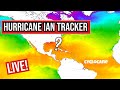
Cyclocane
( cyclocane is a CYCLOne and hurriCANE tracker by hayley )


Hurricane Watch - Miami FL AL092022
972
WTUS82 KMFL 291217
HLSMFL
FLZ063-066>075-168-172>174-292030-
Tropical Storm Ian Local Statement Intermediate Advisory Number 27A
National Weather Service Miami FL AL092022
817 AM EDT Thu Sep 29 2022
This product covers South Florida
All Warnings Cancelled for Mainland South Florida. Surge Waters
will continue to recede across Coastal Collier
NEW INFORMATION
CHANGES TO WATCHES AND WARNINGS:
- All watches and warnings have been canceled
- All watches and warnings have been canceled
CURRENT WATCHES AND WARNINGS:
- None
- None
STORM INFORMATION:
- About 130 miles north-northwest of West Palm Beach FL or about
180 miles north-northeast of Naples FL - 28.5N 80.7W
- Storm Intensity 65 mph
- Movement Northeast or 35 degrees at 8 mph
- About 130 miles north-northwest of West Palm Beach FL or about
SITUATION OVERVIEW
Tropical Storm Ian will move off the east coast of Florida this
morning and move slowly towards the southeast of the United States
later today into Friday. The following hazardous conditions can be
expected for South Florida:
Storm Surge in flooded areas across Coastal Collier County will
continue to recede today. However, standing water in some areas
will still be common and could be 1 to 3 feet. Please do not
venture out into floodwater. Floodwater may contain hazardous
materials, such as downed power lines, hazardous waste, and
physical objects. You never know how deep floodwater is and what
may be in floodwater. The best way to protect yourself is to stay
out of floodwater and sheltered in place while water recedes.
Additional flooding may be possible today especially during high
tide. Please heed the advice of local emergency management
officials and first responders as search and rescue efforts are
ongoing.Hazardous marine, beach, and surf conditions are ongoing.
POTENTIAL IMPACTS
SURGE:
Little to no additional surge impacts expected.- Community officials are now assessing the extent of actual
surge impacts accordingly across coastal Collier County. - Emergency response teams are attending to casualty situations
as needed. - Emergency work crews are restoring essential community
infrastructure as necessary. - If you have an emergency dial 9 1 1.
- Community officials are now assessing the extent of actual
PRECAUTIONARY/PREPAREDNESS ACTIONS
EVACUATIONS:
Do not enter evacuated areas until officials have
given the all clear to return.OTHER PREPAREDNESS INFORMATION:
Do not attempt to return to evacuated areas until local authorities
give the all clear. Allow time for officials to inspect bridges and
overpasses and to mark washed-out roads.
If using a generator, avoid carbon monoxide poisoning by following
instructions provided by the manufacturer. Operate your generator in
a well-ventilated space outside of your living area and away from
open doors and windows.
Problems with sewer backups can further contaminate standing flood
waters. Keep children away from flood waters. Also, listen for boil
water alerts as tap water may have become non-potable.
Be alert for flooded roads which could be compromised or littered
with debris. Avoid travel until water levels subside and roads have
been cleared. Do not drive through places where flood waters cover
the road. Turn around, don't drown!
- ADDITIONAL SOURCES OF INFORMATION:
- For information on appropriate preparations see ready.gov
- For information on creating an emergency plan see getagameplan.org
- For additional disaster preparedness information see redcross.org
NEXT UPDATE
As it pertains to this event...this will be the last local statement
issued by the National Weather Service in Miami FL regarding the
effects of tropical cyclone hazards upon the area.
972
      WTUS82 KMFL 291217
      HLSMFL
      FLZ063-066>075-168-172>174-292030-

      Tropical Storm Ian Local Statement Intermediate Advisory Number 27A
      National Weather Service Miami FL  AL092022
      817 AM EDT Thu Sep 29 2022

      This product covers South Florida

      **All Warnings Cancelled for Mainland South Florida. Surge Waters
      will continue to recede across Coastal Collier**

      NEW INFORMATION
      ---------------

      * CHANGES TO WATCHES AND WARNINGS:
          - All watches and warnings have been canceled

      * CURRENT WATCHES AND WARNINGS:
          - None

      * STORM INFORMATION:
          - About 130 miles north-northwest of West Palm Beach FL or about
            180 miles north-northeast of Naples FL
          - 28.5N 80.7W
          - Storm Intensity 65 mph
          - Movement Northeast or 35 degrees at 8 mph

      SITUATION OVERVIEW
      ------------------

      Tropical Storm Ian will move off the east coast of Florida this
      morning and move slowly towards the southeast of the United States
      later today into Friday. The following hazardous conditions can be
      expected for South Florida:

      * Storm Surge in flooded areas across Coastal Collier County will
        continue to recede today. However, standing water in some areas
        will still be common and could be 1 to 3 feet. Please do not
        venture out into floodwater. Floodwater may contain hazardous
        materials, such as downed power lines, hazardous waste, and
        physical objects. You never know how deep floodwater is and what
        may be in floodwater. The best way to protect yourself is to stay
        out of floodwater and sheltered in place while water recedes.
        Additional flooding may be possible today especially during high
        tide. Please heed the advice of local emergency management
        officials and first responders as search and rescue efforts are
        ongoing.

      * Hazardous marine, beach, and surf conditions are ongoing.

      POTENTIAL IMPACTS
      -----------------

      * SURGE:
      Little to no additional surge impacts expected.

          - Community officials are now assessing the extent of actual
            surge impacts accordingly across coastal Collier County.
          - Emergency response teams are attending to casualty situations
            as needed.
          - Emergency work crews are restoring essential community
            infrastructure as necessary.
          - If you have an emergency dial 9 1 1.


      PRECAUTIONARY/PREPAREDNESS ACTIONS
      ----------------------------------

      * EVACUATIONS:

      - Do not enter evacuated areas until officials have
      given the all clear to return.

      * OTHER PREPAREDNESS INFORMATION:

      Do not attempt to return to evacuated areas until local authorities
      give the all clear. Allow time for officials to inspect bridges and
      overpasses and to mark washed-out roads.

      If using a generator, avoid carbon monoxide poisoning by following
      instructions provided by the manufacturer. Operate your generator in
      a well-ventilated space outside of your living area and away from
      open doors and windows.

      Problems with sewer backups can further contaminate standing flood
      waters. Keep children away from flood waters. Also, listen for boil
      water alerts as tap water may have become non-potable.

      Be alert for flooded roads which could be compromised or littered
      with debris. Avoid travel until water levels subside and roads have
      been cleared. Do not drive through places where flood waters cover
      the road. Turn around, don't drown!

      * ADDITIONAL SOURCES OF INFORMATION:
      - For information on appropriate preparations see ready.gov
      - For information on creating an emergency plan see getagameplan.org
      - For additional disaster preparedness information see redcross.org

      NEXT UPDATE
      -----------

      As it pertains to this event...this will be the last local statement
      issued by the National Weather Service in Miami FL regarding the
      effects of tropical cyclone hazards upon the area.

      $$
[source] site by Hayley Croft
- Tell your friends about Cyclocane
- make a donation - totally optional but completely appreciated
Make a monthly donation or a one-time donation to help support ongoing costs with Cyclocane.
Play solitaire and track all of the cyclocane storms at the same time at Hurricane Solitaire.