Cyclocane
( cyclocane is a CYCLOne and hurriCANE tracker by hayley )

English Español Deutsch Français 日本語
This is the final warning / advisory for this storm as it has weakened below warning levels and/or the storm system is no longer a tropical cyclone.
ALETTA Current Status
Current Wind Speed 20 knots / 25 MPH
Max Predicted Wind Speed 20 knots / 25 MPH at

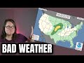
ALETTA Land Hazards
ALETTA Tracker
ALETTA Satellite Loop

ALETTA Alternate Tracking Map
ALETTA Spaghetti Models
Spaghetti models for ALETTA can be found here:
ALETTA spaghetti models page »
ALETTA Watches and Warnings

Post-Tropical Cyclone ALETTA Tropical Cyclone Update
Post-Tropical Cyclone ALETTA Public Advisory
000
WTPZ31 KNHC 060232
TCPEP1

BULLETIN
Post-Tropical Cyclone Aletta Advisory Number   7
NWS National Hurricane Center Miami FL       EP012024
800 PM MST Fri Jul 05 2024

...ALETTA DEGENERATES TO A REMNANT LOW...
...THIS IS THE FINAL ADVISORY...


SUMMARY OF 800 PM MST...0300 UTC...INFORMATION
----------------------------------------------
LOCATION...18.4N 111.6W
ABOUT 330 MI...530 KM SSW OF THE SOUTHERN TIP OF BAJA CALIFORNIA
MAXIMUM SUSTAINED WINDS...25 MPH...35 KM/H
PRESENT MOVEMENT...W OR 260 DEGREES AT 10 MPH...17 KM/H
MINIMUM CENTRAL PRESSURE...1007 MB...29.74 INCHES


WATCHES AND WARNINGS
--------------------
There are no coastal watches or warnings in effect.


DISCUSSION AND OUTLOOK
----------------------
At 800 PM MST (0300 UTC), the center of Post-Tropical Cyclone Aletta
was located near latitude 18.4 North, longitude 111.6 West. The
post-tropical cyclone is moving toward the west near 10 mph (17
km/h). This general motion is expected to continue until Aletta
dissipates on Saturday.

Maximum sustained winds are near 25 mph (35 km/h) with higher gusts.
Gradual weakening is forecast to continue, and Aletta is expected
to dissipate on Saturday.

The estimated minimum central pressure is 1007 mb (29.74 inches).


HAZARDS AFFECTING LAND
----------------------
None.


NEXT ADVISORY
-------------
This is the last public advisory issued by the National Hurricane
Center on this system.

$$
Forecaster Hagen/Cangialosi
Public Advisory not available for this storm.
Post-Tropical Cyclone ALETTA Forecast Discussion
000
WTPZ41 KNHC 060232
TCDEP1

Post-Tropical Cyclone Aletta Discussion Number   7
NWS National Hurricane Center Miami FL       EP012024
800 PM MST Fri Jul 05 2024

Convection has continued to diminish in association with Aletta.
Little or no organized deep convection has been seen since late
Thursday morning. Both the GFS and the ECMWF simulated satellite
imagery do not indicate any return of deep convection. Given the
marginal environment, the remnant low should continue to spin down.
Aletta is forecast to dissipate on Saturday.

Do to the very poor appearance on satellite imagery and the lack of
any pressure gradients in the area, the initial intensity has been
lowered to 20 kt. Socorro Island measured a maximum wind of 21 kt a
few hours ago as Aletta passed just south of the island.  Earlier
ASCAT-B data from 1712 UTC only showed peak winds in the 20-25 kt
range at that time.

No significant change has been made to the NHC track forecast.
Aletta should continue to be steered by the low-level flow in a
direction just south of due west until it dissipates.


FORECAST POSITIONS AND MAX WINDS

INIT  06/0300Z 18.4N 111.6W   20 KT  25 MPH...POST-TROPICAL
 12H  06/1200Z 18.3N 112.8W   20 KT  25 MPH...POST-TROP/REMNT LOW
 24H  07/0000Z...DISSIPATED

$$
Forecaster Hagen/Cangialosi
ALETTA storm path from NHC
| Time | Speed | Location | Status |
|---|---|---|---|
| 20 knots | 18.4, -111.6 | translation missing: en.POST-TROPICAL | |
| 20 knots | 18.3, -112.8 | POST-TROPICAL CYCLONE | |
| 0 knots | translation missing: en.DISSIPATED |
site by Hayley Croft
Hi, I'm Hayley. Did you know that I run this site out of my own pocket? So if you'd like to help support this site:
- Tell your friends about Cyclocane
- Buy something through this Amazon Cyclocane link
- make a donation - totally optional but completely appreciated
Make a monthly donation or a one-time donation to help support ongoing costs with Cyclocane.
Play solitaire and track all of the cyclocane storms at the same time at Hurricane Solitaire.